Contribution at the conference "Digital Crossroads" of the "Computer Applications & Quantitative Methods in Archaeology" organization (CAA), virtually in Limassol, Cyprus, 14-18 June 2021, presented online by Caroline von Nicolai in Session S16 on 2021-06-17
Thank you for the possibility to present our interdisciplinary project "Digital Iron Age" (EisenzeitDigital; EZD) on this occasion. The thanks also come from my colleague Stephan Lücke who unfortunately can not attend this presentation.
1. The Key Facts
EisenzeitDigital (Digital Iron Age)
1.1. Introduction: What is "Digital Iron Age"?
Digital Iron Age is an interdisciplinary project focusing on teaching methods of Digital Humanities to archaeology students (undergraduate and graduate level).
The project combines two goals:
- Training students in the use of databases and the programs (My)SQL, QGIS for visualisation, and R for statistical analysis, in order to increase their job opportunities inside and outside academic institutions.
- Building a database of all Iron Age sites in Bavaria and studying their distribution and the dynamics of Iron Age settlements in Bavaria between the eighth and first centuries BC.
In the following, I will give a short introduction to the structure and the preliminary results of the project.
1.2. Who runs the project?
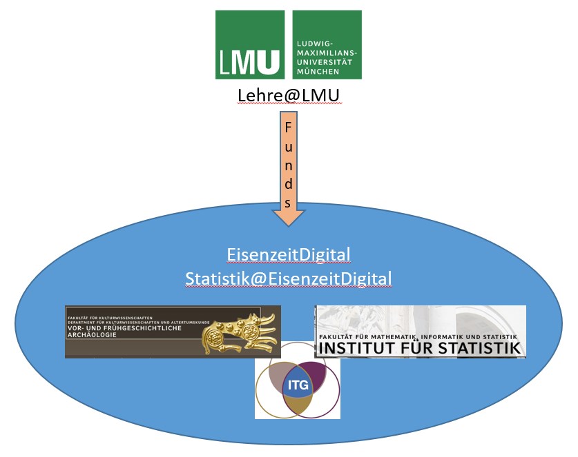
Institutional setting of EisenzeitDigital and Statistik@EisenzeitDigital.
The project is run as a cooperation of three different institutions at Ludwig-Maximilians-University (LMU) in Munich, Germany:
-
- the Institute for Prehistorc and Protohistoric Archeaology and Archaeology of the Roman Province (Dr. Caroline von Nicolai),
- the Institute for Statistics (Prof. Dr. Helmut Küchenhoff) and
- the LMU Center for Digital Humanities (Dr. Stephan Lücke), an institution of the LMU run by the humanities faculties of the LMU. Its task is to support researchers in the field of digital research and teaching, in technical and methodological terms.
Over the past four years the project has twice been funded by Lehre@LMU, a scheme aiming to support the development of digital training courses to improve teaching at LMU Munich.
1.3. What did we do?
Workflow and modules.
Students were taught
-
- how to store, administer and analyze archeological data in a relational database
- how to visualize these data on digital maps using the program QGIS
- how to apply statistical methods and how to use the program "R"
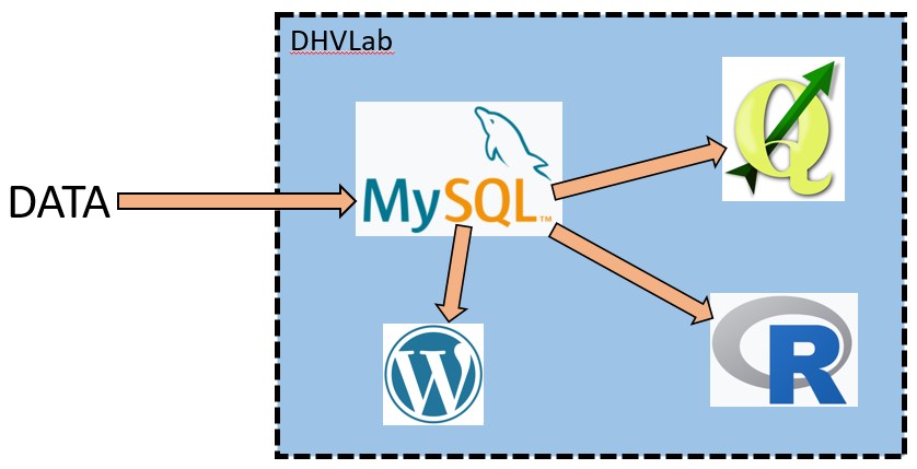
Both the database and the analysis tools are accessed via a virtual platform called "Digital Humanities Virtual Laboratory", DHVLab, which has been developed as a teaching platform as part of the initiative “Digital Campus of Bavaria” (Digitaler Campus Bayern).
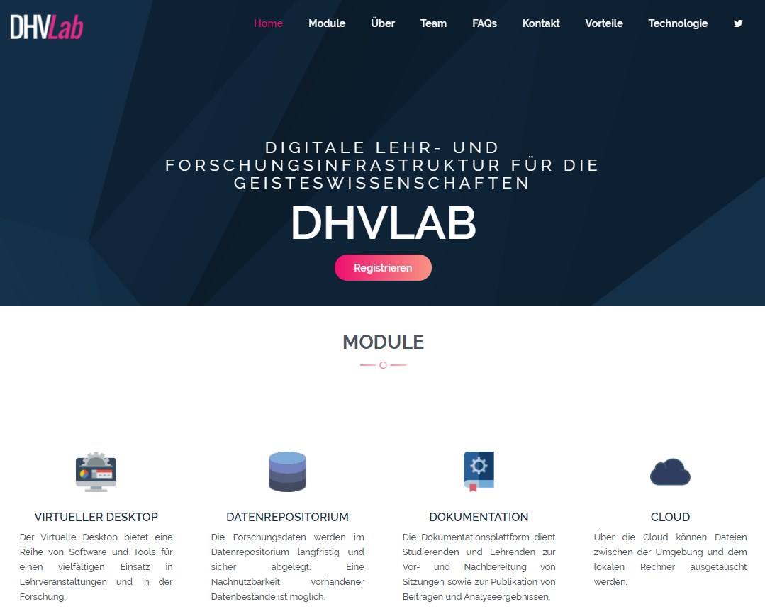
Frontpage of the "Digital Virtual Lab" (DHVLab).
DHVLab comprises a series of digital tools all of which can be accessed and used online. Most important for the project Digital Iron Age are:
- The Virtual Desktop: an environment which provides every student with a personal Linux-based virtual machine. The main advantage is that students do not have to install software required in the course on their own computers.
Virtual Desktop with a personal Linux-based virtual machine.
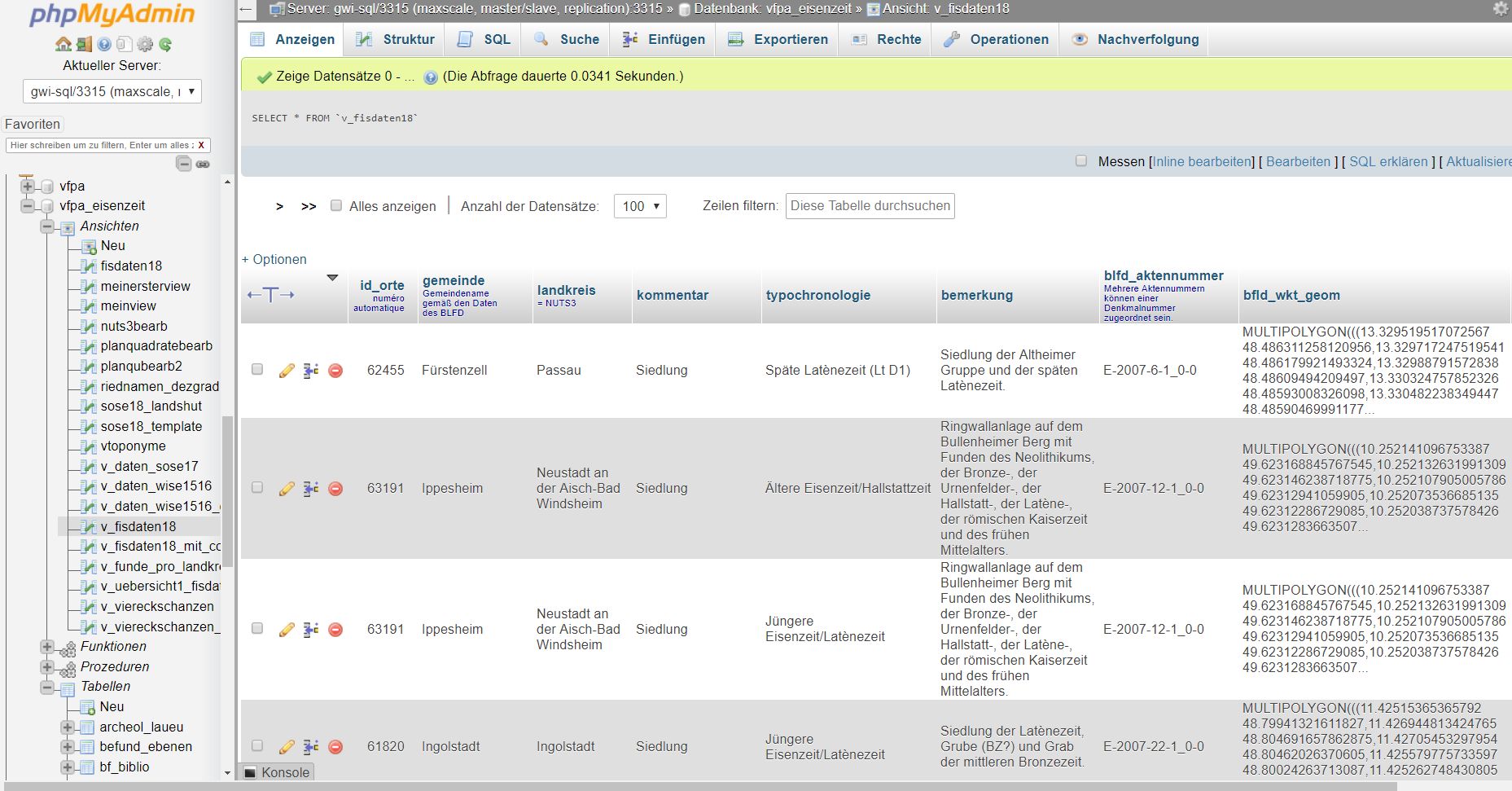
MySQL-database of EisenzeitDigital.
- A WordPress-based documentation platform, called DH-Lehre. The WordPress-Environment is used as part of an inverted classroom approach. Lecture content is shared with the students in video or text format, while classroom time is purely dedicated to discuss topics in greater depth and to clarify open questions. Both lecturers and students share their work and have the opportunity to comment and interact in a non-hierarchical way.
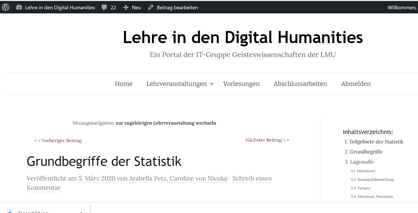
WordPress-based documentation platform used to prepare classes.
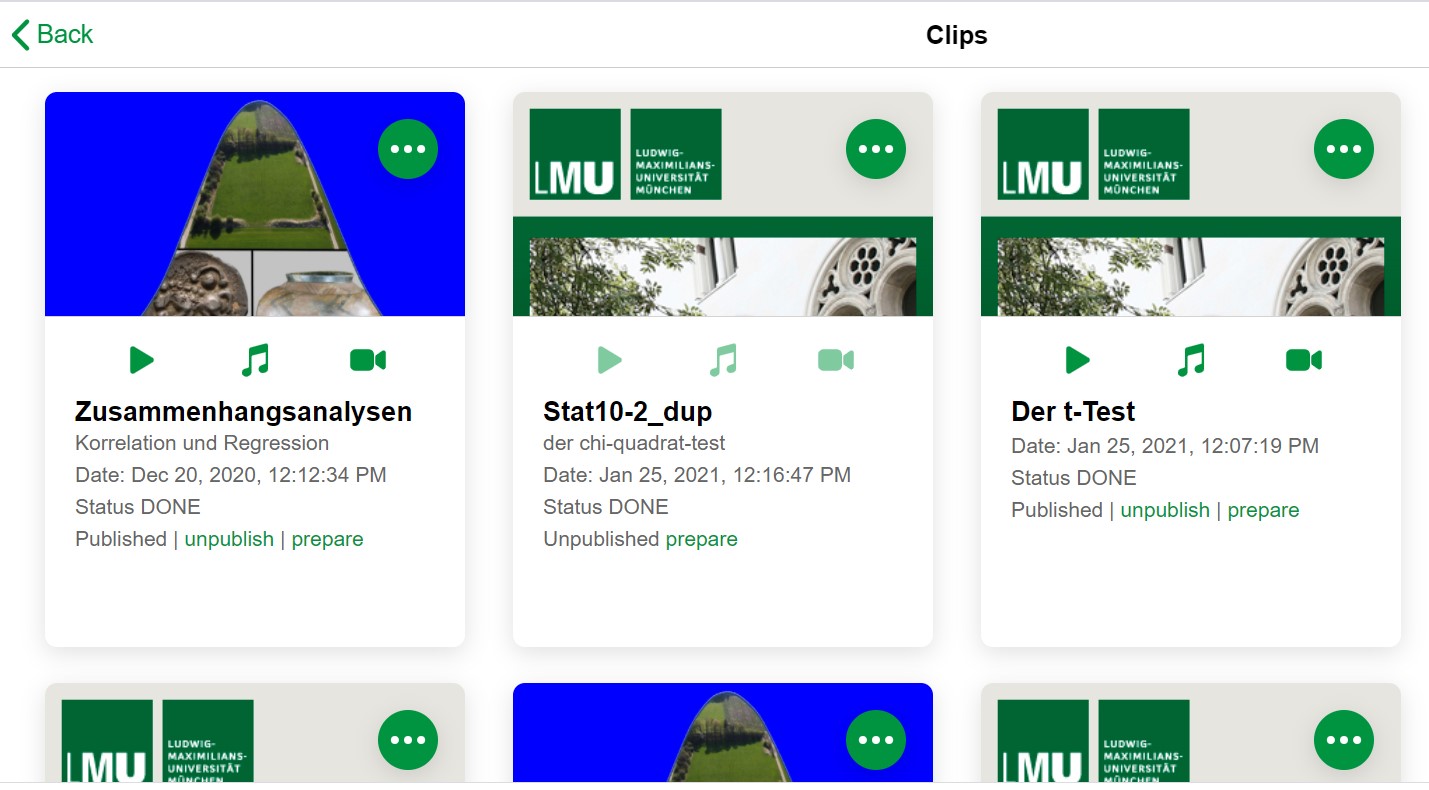
Videos used to prepare classes.
The project was run in two consecutive stages:
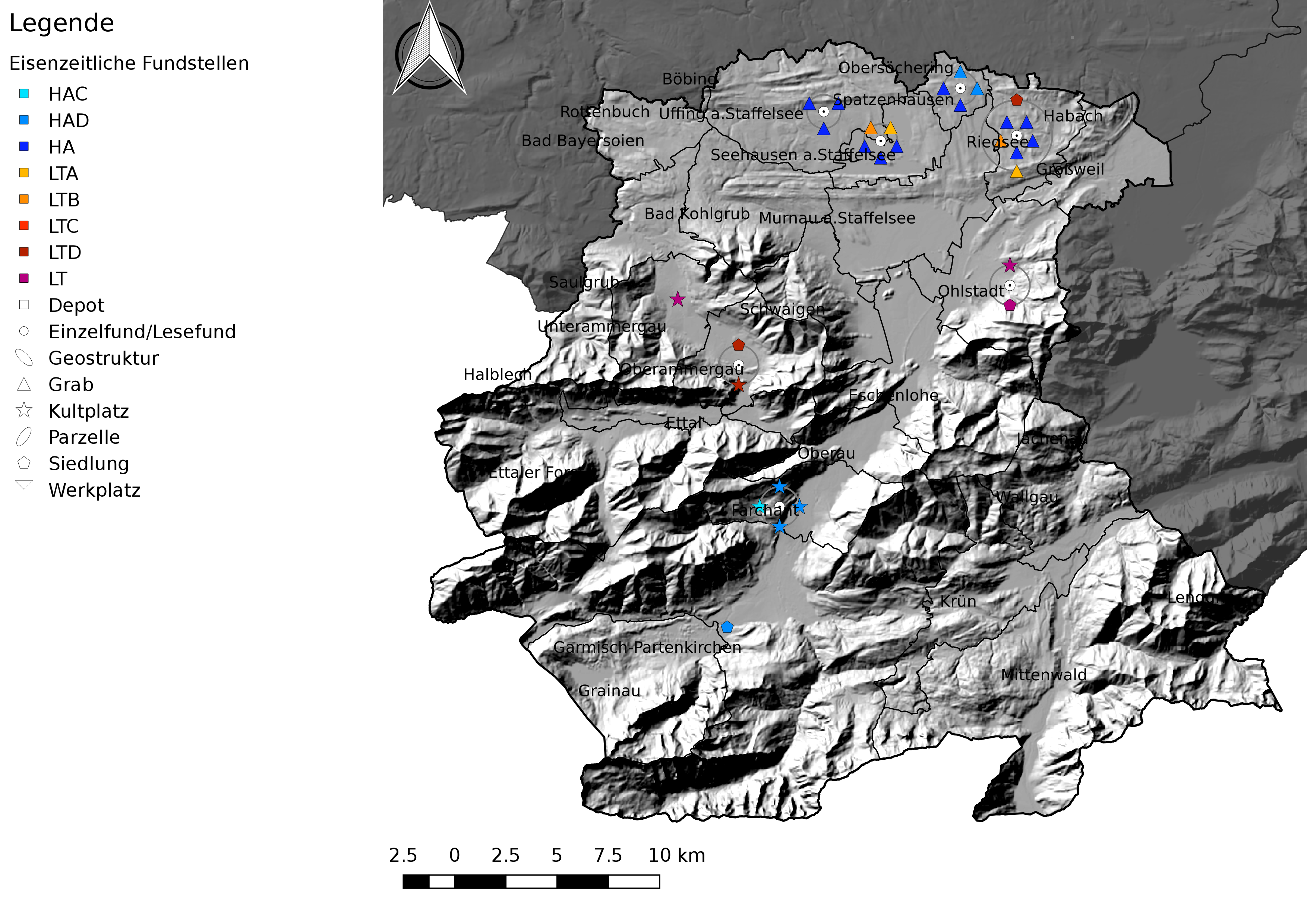
Iron Age sites in the district of Garmisch-Partenkirchen (© R. Franke. Generated with QGIS; data: Bayerisches Landesamt für Denkmalpflege 2017).
-
- The first stage, entitled "EisenzeitDigital", was mainly devoted to the the use of relational databases and to vizualisation using QGIS;
- In the second stage, "Statistik@EisenzeitDigital", students learned how to apply statistical methods on the gathered archeological data.
2. The Iron Age in Bavaria
2.1. The data
The database is fed by different sources including:
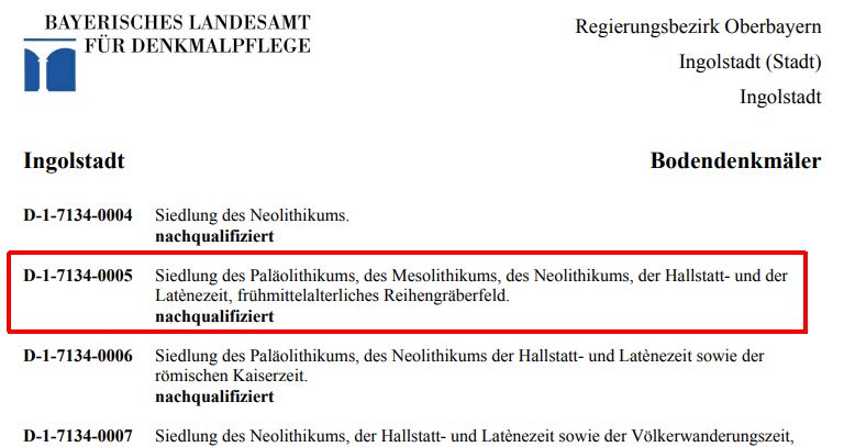
- The information system (Fachinformationssystem, FIS) compiled by the Bavarian State Office of Heritage (Bayerisches Landesamt für Denkmalpflege)
List of archaeological monuments compiled by the Bavarian State Office of Heritage.
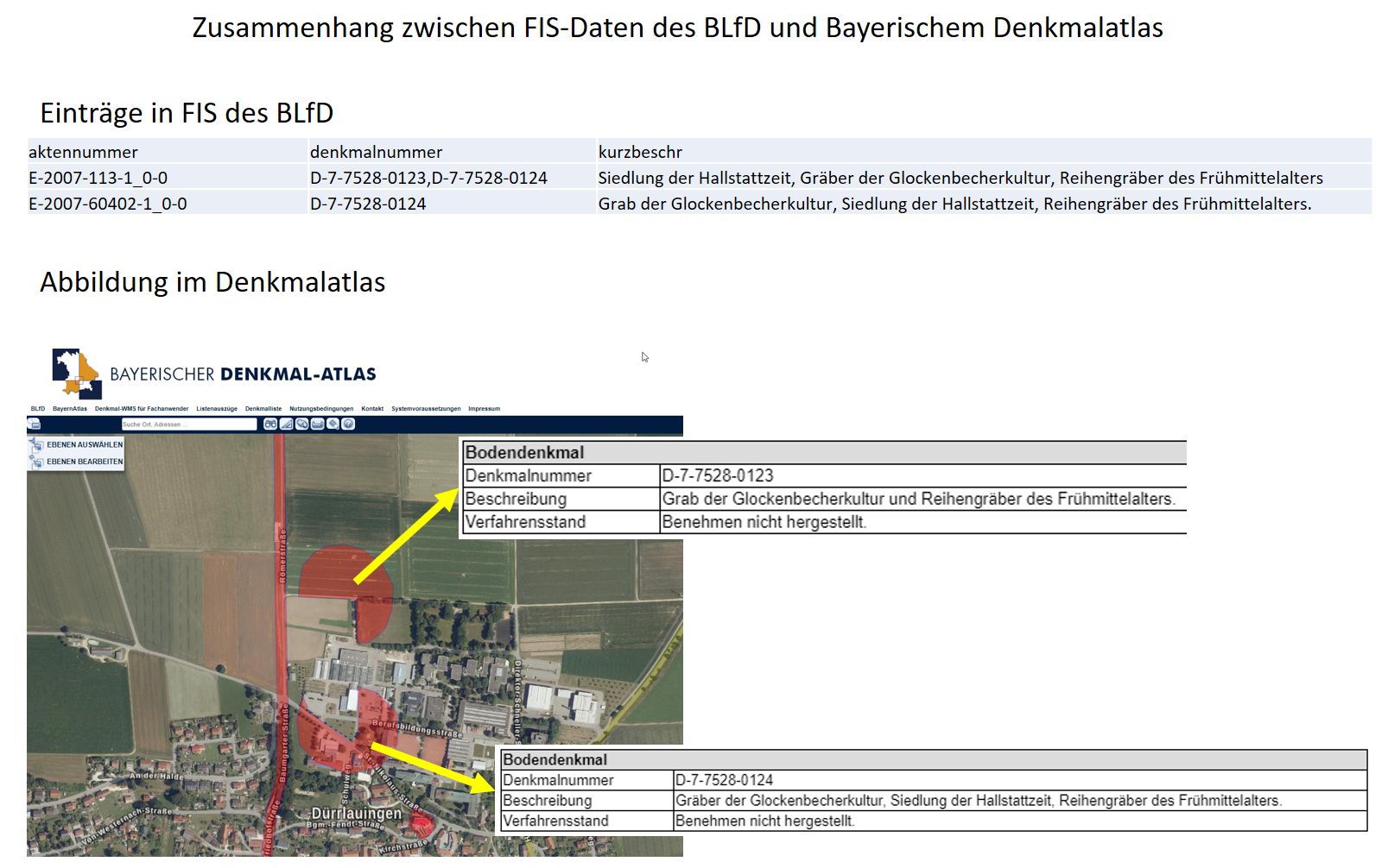
Information system compiled by the Bavarian State Office of Heritage.
- The Bavarian Atlas of Monuments (Bayerischer Denkmal-Atlas)
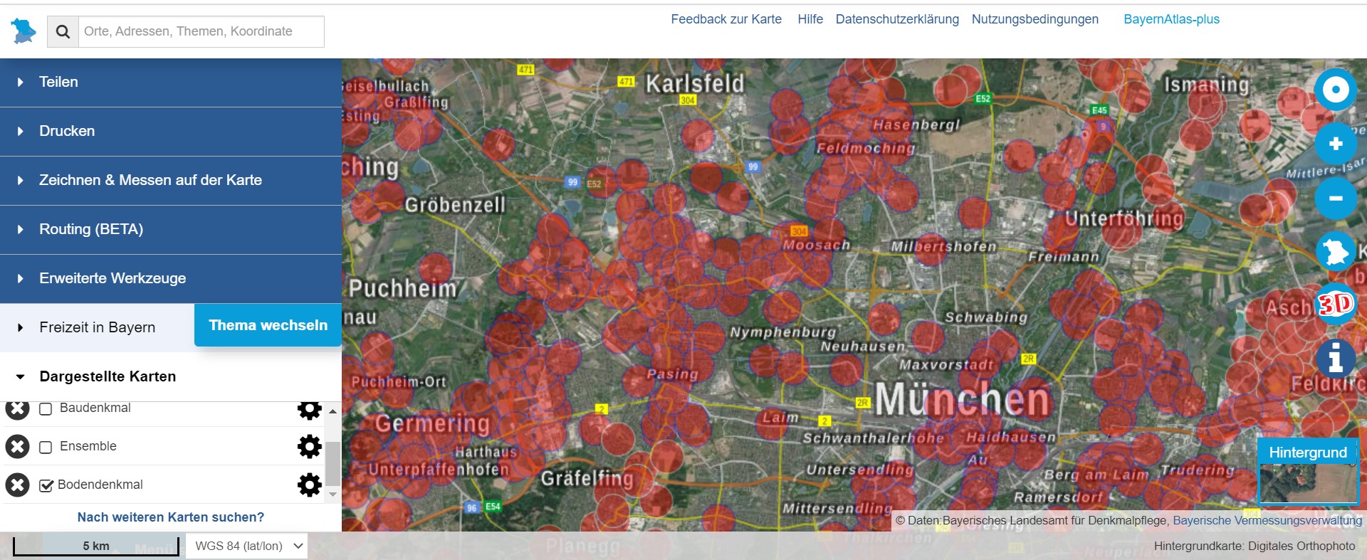
Bavarian Atlas of Monuments (http://geoportal.bayern.de/bayernatlas-klassik/
- Publications, such as monographs and regional journals
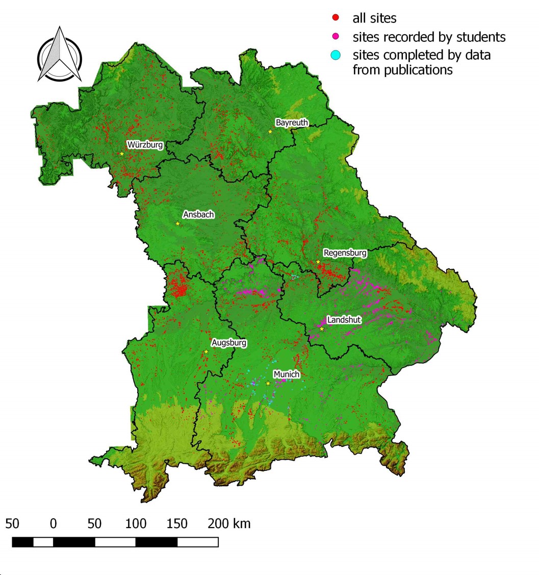
Sites registered in the database so far (CC BY-SA 4.0 authors).
- Free Web Map Services (WMS) data provided by different state and federal institutions contain additional information on hydrology, pedology, geology, flood risks, etc.
Free Web Map Services (WMS).
2.2. Some scientific results
So far, our main focus has been to teach the students the necessary technical skills to use MySQL, QGIS, and R, while the data processing and analysis are still in its beginnings. Therefore, we can only give an idea how we will use and interpret the data in more detail in the future.
The total number of sites used in the following is 10.772.
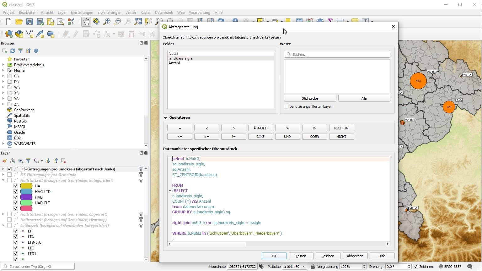
Dialog box in QGIS for entering a SQL statement to retrieve georeferenced data from the MySQL database (CC BY-SA 4.0 authors).
Mapping of the Iron Age sites in Bavaria revealed a bimodal distribution of settlements during both the Hallstatt and La Tène periods.
Most sites are located along the rivers Danube, Isar and Main, as well as in and around the modern agglomerations. This site distribution is hardly surprising since large river valleys have been densely populated ever since Neolithic times. Areas with good soils generally yield high agricultural returns making them favourable locations for settlements.
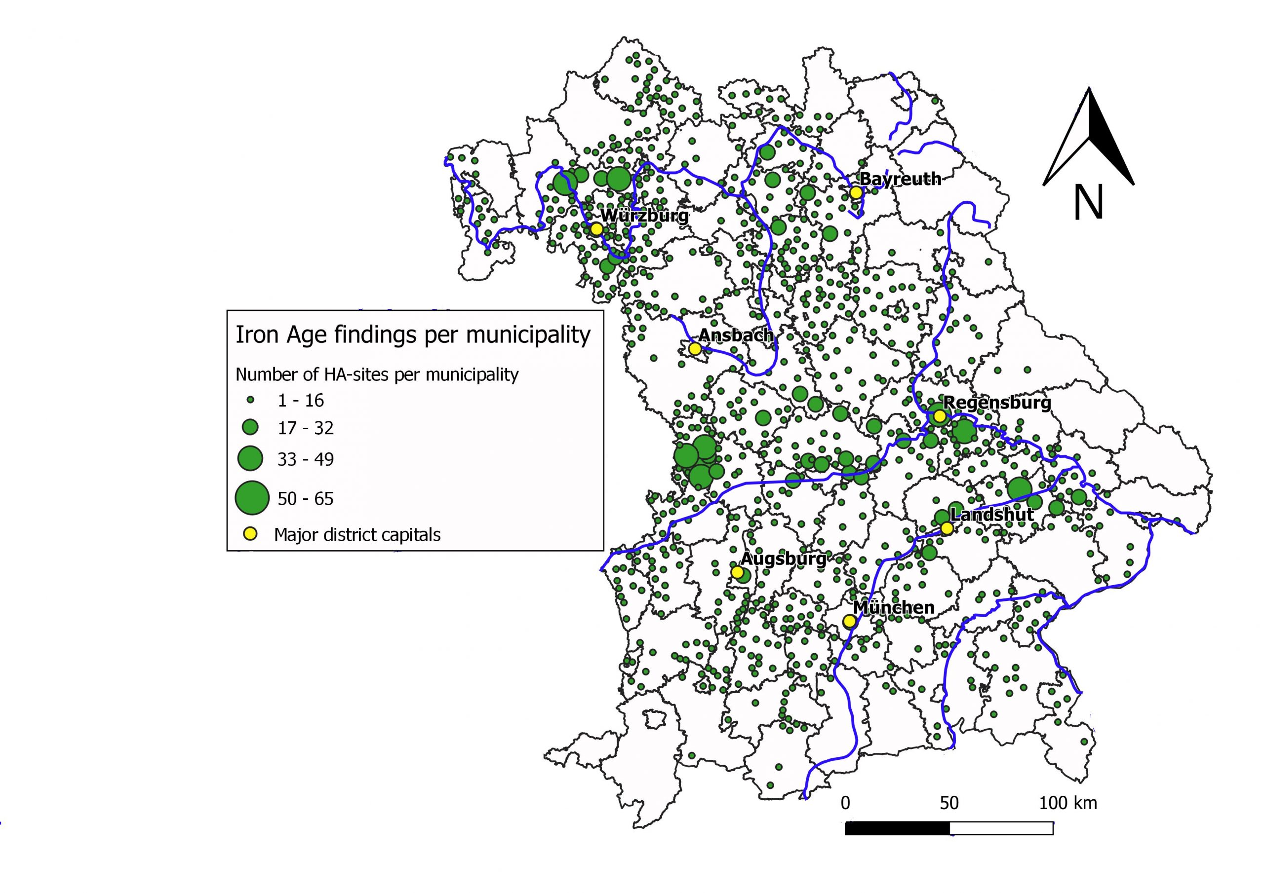
Distribution of sites belonging to the Hallstatt period in Bavaria, aggregated by modern municipalities. N = 4506 (CC BY-SA 4.0 authors. Generated with QGIS; data: Bayerisches Landesamt für Denkmalpflege).
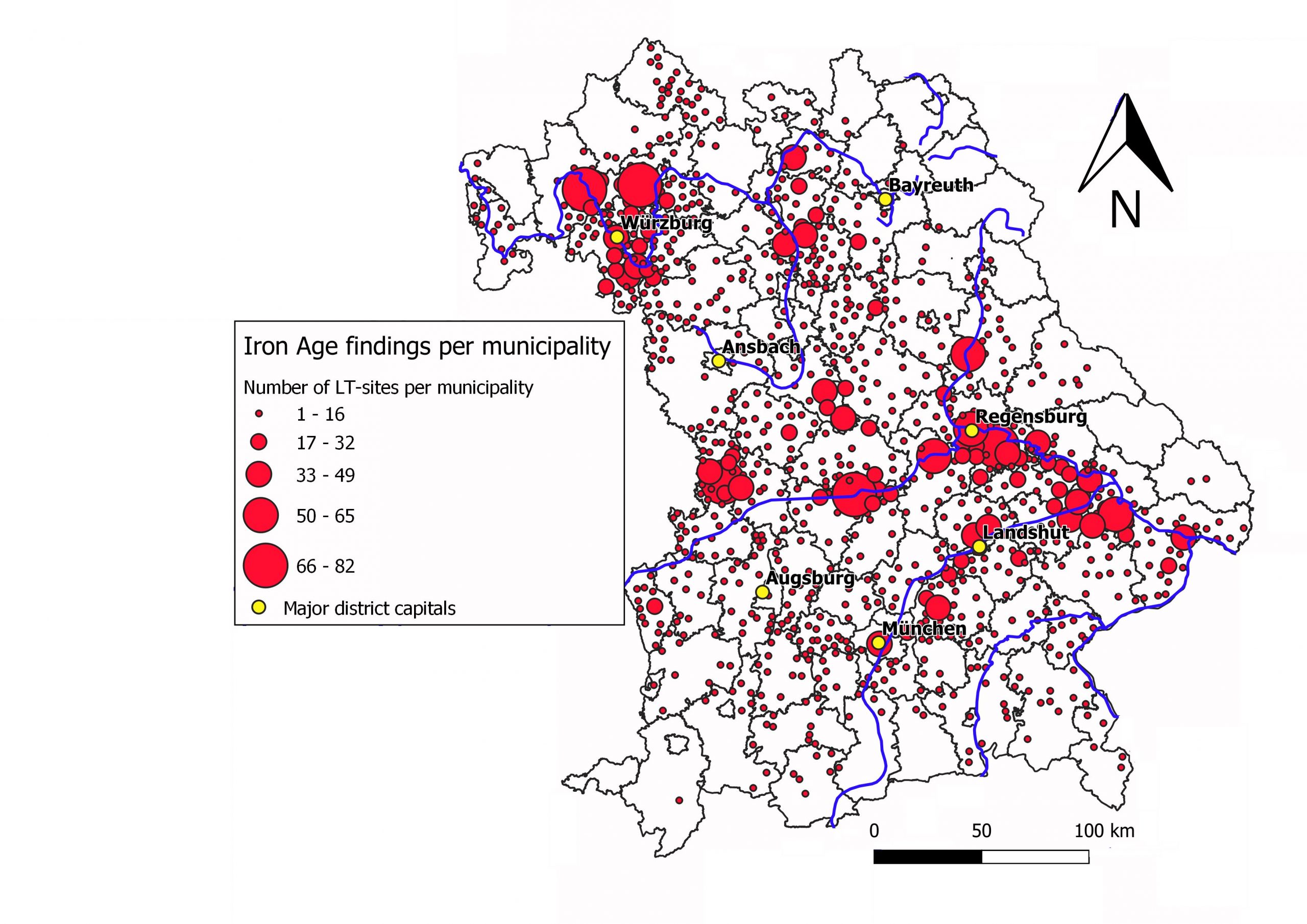
Distribution of sites belonging to the La Tène period in Bavaria, aggregated by modern municipalities. N = 6266 (CC BY-SA 4.0 authors. Generated with QGIS; data: © Bayerisches Landesamt für Denkmalpflege 2017).
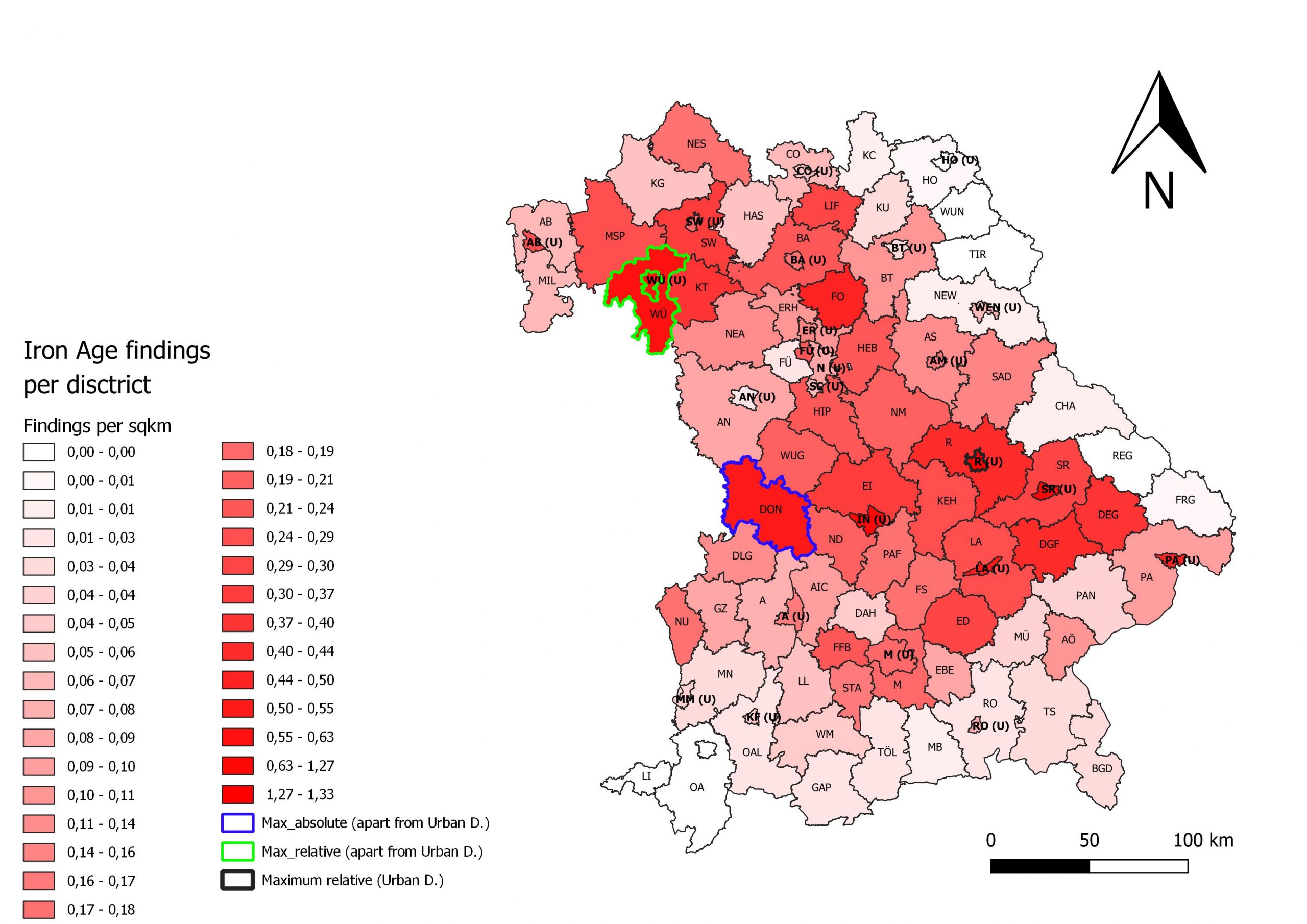
Number of sites per district (LK, Landkreis) registered in EZD. Blue borders the district with the highest absolute value (Landkreis Donau-Ries). N = 10772 (CC BY-SA 4.0 authors. Generated with QGIS; data: © Bayerisches Landesamt für Denkmalpflege 2017).
The Nördlinger Ries in the district of Donau-Ries (DON, county of Swabia), for instance, is an impact crater that is characterized by fertile loess soils and a mild climate, so its settlement density was high in almost all prehistoric periods.
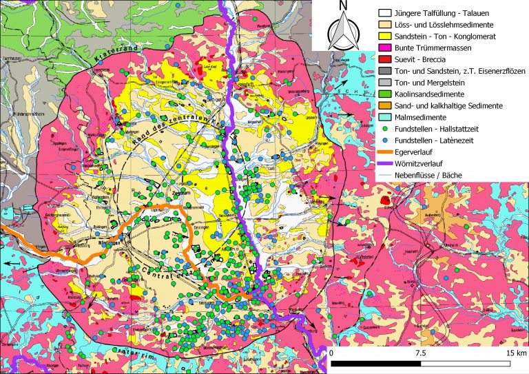
Distribution of Iron Age sites in the impact crater of the Nördlinger Ries, according to the geological subsoil (© N. Michelidakis. Data: Bayerisches Landesamt für Umwelt www.lfu.bayern.de, Bundesamt für Kartographie und Geodäsie www.bkg.bund.de).
It has also yielded a very large number of sites from the Iron Age: Currently 701 sites are registered in the database over an area of 1.275 km2 (0,55 per km2). That is the highest absolute number of Iron Age findings in a Bavarian district.
However, we have to consider several biases when studying the distribution of sites:

Archaeological site discovered during the construction of a route (© K. Leidorf).
- Most archaeological sites are discovered in modern urban areas and industrial zones, as well as along highways, high-speed train lines, power supply lines, and gas pipelines, due to necessary rescue excavations.
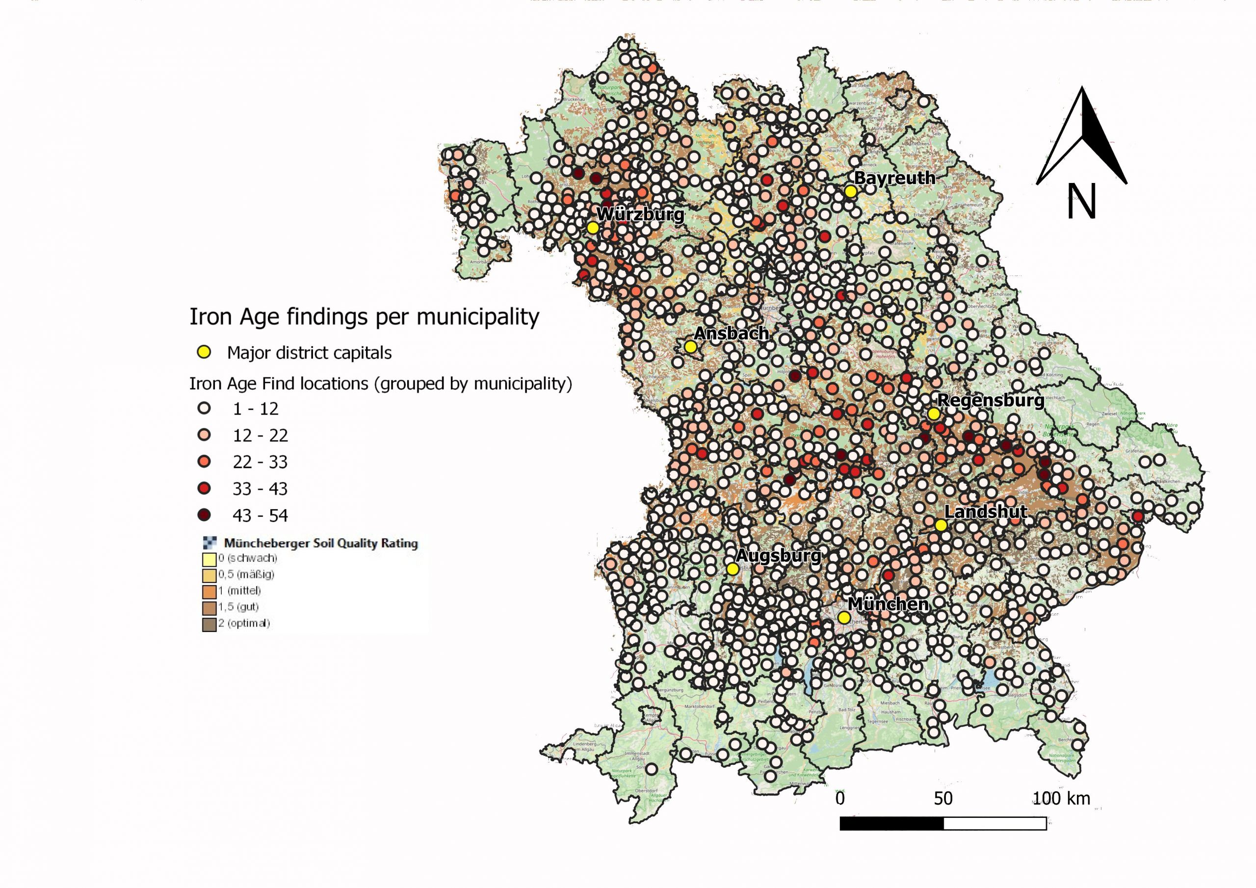
Distribution of Iron Age sites in relation to soil quality (the darker the brown, the better the quality according to the Müncheberger Soil Quolity Rating. N = 10.772 (CC BY-SA 4.0 authors. Generated with QGIS; data: © Bayerisches Landesamt für Denkmalpflege 2017 and Bundesanstalt für Geowissenschaften und Rohstoffe, BGR [https://services.bgr.de/wms/boden/sqr1000/?version=1.3.0].
- Regions whose soils are intensively ploughed and cultivated generally yield a large number of sites.
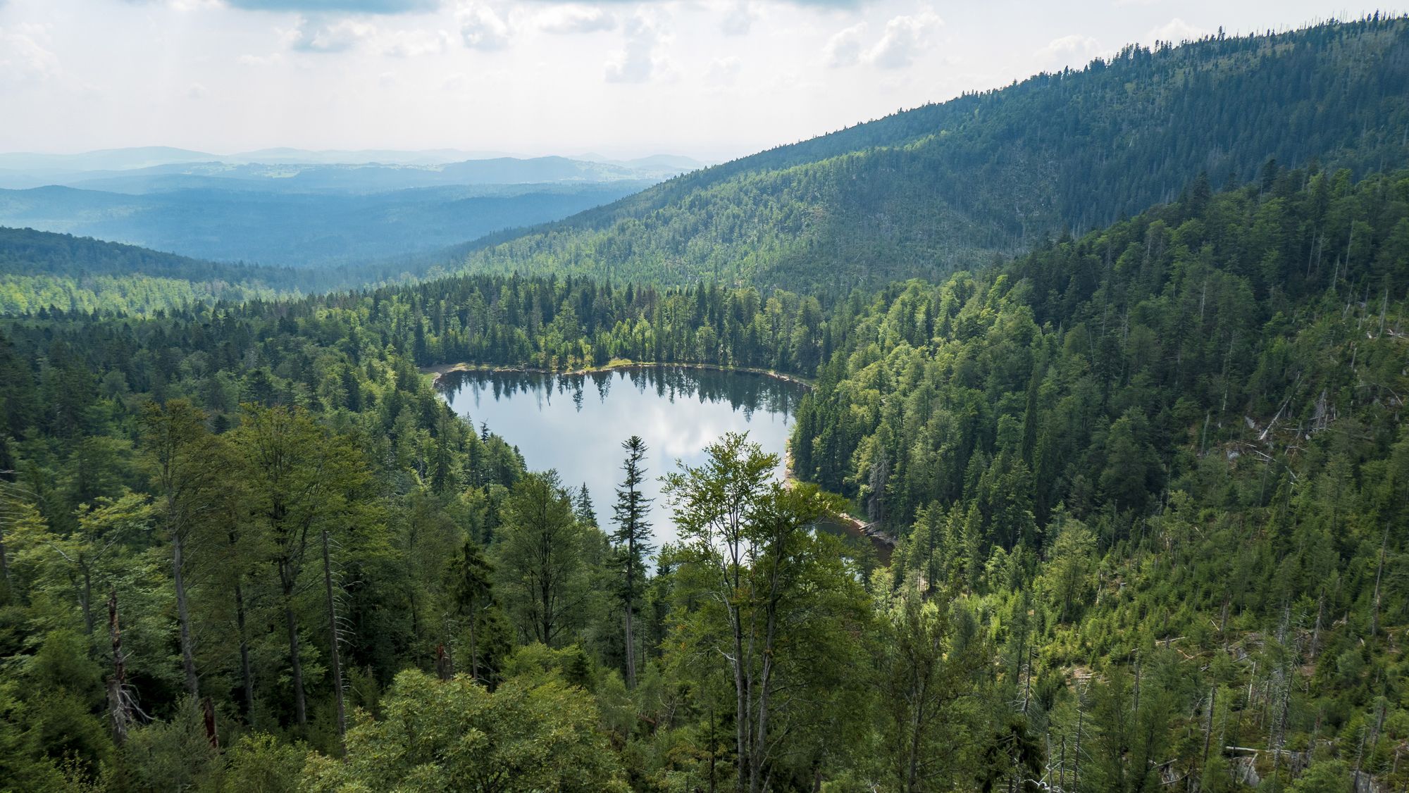
The Bavarian Forest forms the largest contiguous area of woodland in Bavaria (© picture alliance / DUMONT Bildarchiv).
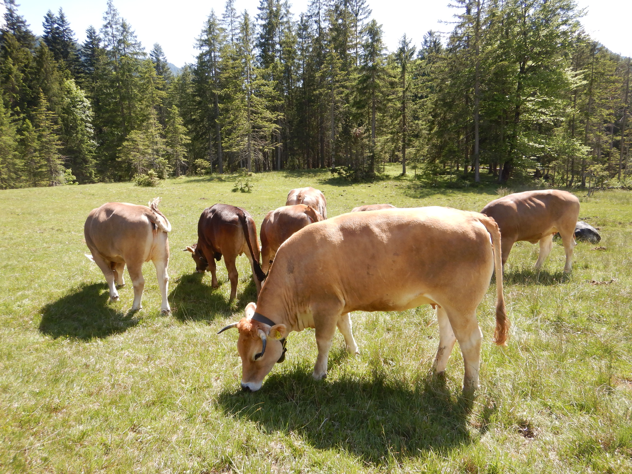
Pastoralism is the dominant form of agriculture in the southernmost parts of Bavaria (© M. Fesq-Martin).
- The Bavarian-Bohemian Forest, on the other hand, forms the largest contiguous area of woodland in Bavaria. Forests and hilly meadowlands, mostly used for pastoralism, characterize the southern districts of Bavaria. Both regions are not densely populated today, larger cities are missing. Therefore, archaeological sites are less likely to be found and excavated.
The site distribution may also be biased by factors such as
Archaeological site destroyed by looters using metal detectors (© M. Fesq-Martin).
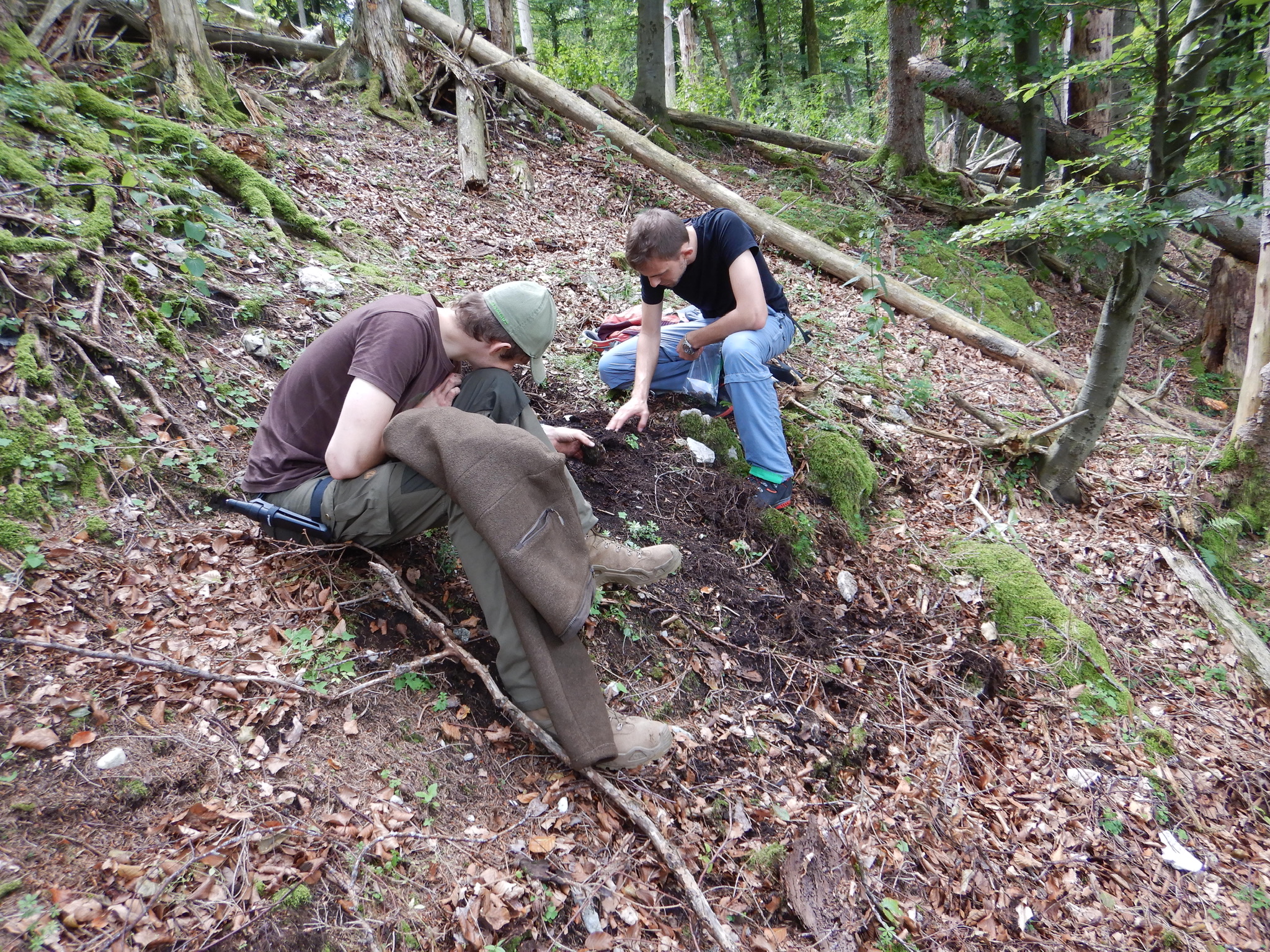
- the activities of voluntary collectors, professional archaeologists, and looters using metal detectors;
- Different building techniques and burial procedures of variable preservation potential that dominated in different periods of the Iron Age;
- Micro-mobility: prehistoric settlements in Temperate Europe were generally short-lived and were often abandoned and transferred to a nearby location once the natural resources of an area (soils, forests, pastures, etc.) were exhausted;
- Dating of the sites registered in the database EZD is not precise enough to decide whether several settlements of the same period situated in a small area were all contemporary or in use one after another.
In spite of these important positive and negative biases, we can still assume that the settlement density was really lower in the Alpine foreland and in the Bavarian Forest than in other parts of Bavaria:
- First, this phenomenon can be observed not only for the Iron Age, but also during other prehistoric periods.
- Second, pollen profiles presenting low human indicators and low NAP (non-arboreal pollen) values, such as Cerealia or Plantago lanceolata, also show that these areas were settled later and less intensely in prehistoric times than the lowland areas with their fertile soils and warm and dry climate.
The reason for these different settlement patterns is that the carrying capacity of the upland areas was lower than elsewhere. The carrying capacity of a region refers to the
“the maximum human population size that can be supported in a given unit of space”, without damaging or destroying its ecological system. It depends on “the physical and biological characteristics of the region being examined”, as well as “on the type of agricultural technology and techniques possessed by the population that affect the productivity of the crops grown in that region” (Currie et al. 2015).
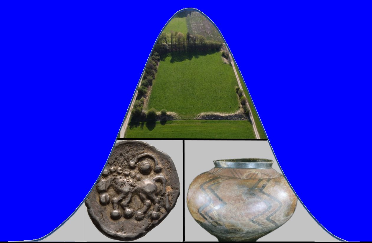
Aerial photography of the Viereckschanze of Neufahrn near Buchendorf, an enclosed farmstead of the Late Iron Age. The wall and ditch of the square enclosure are still well preserved (© F. Fesq).
Therefore, the Viereckschanzen of the Late La Tène period that most archaeologists interpret as enclosed farmsteads were frequent in areas, which were particularly favourable for prehistoric settlements and agriculture, with high annual mean daily insolations, good soil qualities, and easy access to watercourses.
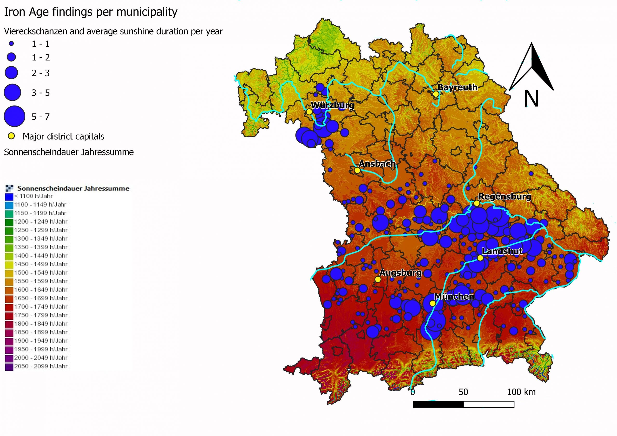
Distribution of Viereckschanzen (n = 465) in relation to the average duration of sunshine per year (red tones stand for relatively many hours of sunshine (CC BY-SA 4.0 authors. Generated with QGIS; data: © Bayerisches Landesamt für Denkmalpflege 2017 and Bayerisches Staatsministerium für Wirtschaft, Infrastruktur, Verkehr und Technologie" [http://wirtschaft-risby.bayern.de/RisGate/servlet/Sonnenscheindauer?])).
The residents of these farmsteads were probably able to produce a surplus of agricultural products, that allowed to feed not only the owners but also one or two dozen of dependants, that were necessary to build the massive enclosures and to run the farmsteads.
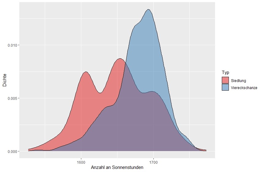
Annual duration of sunshine per year: unenclosed settlements compared to enclosed farmsteads (Viereckschanze) ( © I. Dummert, L. Niedermaier).
On the contrary, in the Alpine foreland and in the Bavarian Forest the possibilities to produce enough food for a large number of inhabitants were certainly restricted in comparison with other areas due to the higher elevation, the lower soil quality, the higher precipitation rate, the shorter vegetation season, the higher number of frost days and the lower solar radiation per year. It is thus hardly surprising that the population density was lower in these mountainous regions, where animal husbandry, especially the raising and breeding of sheep and goats, might have been the predominant form of agriculture in prehistory.
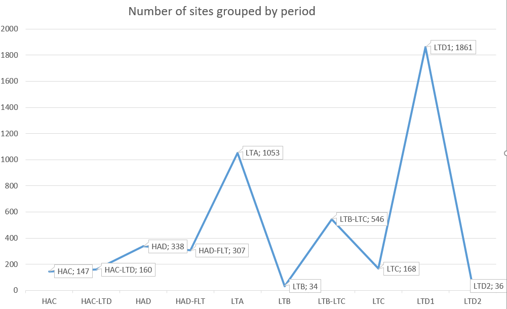
Number of sites from the Iron Age, grouped by periods. The number of sites that could be taken into account for this diagram is only n = 4650 because many others are only attributed to either HA or LT without further specification (CC BY-SA 4.0 authors).
The data query also shows that the number of La Tène sites is higher than that of Hallstatt sites. The dataset contains 6266 records of the La Tène period, in contrast to 4506 sites of the Hallstatt period.
Especially from La Tène C onwards, the number of sites increases considerably, to reach its peak in La Tène D1. In particular, the number of settlements rises substantially since 150 BC.
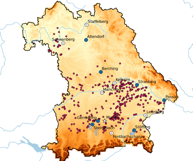
Oppida (urban settlements, white), open agglomerations (blue) and Viereckschanzen (enclosed farmsteads, red) in Bavaria during La Tène D1 (150-80 BC) (CC BY-SA 4.0 authors).
Again, the number of sites is increasing above all in some regions. It is possible that we can link this increase in the number of sites and the site concentrations in certain areas with a population growth, which also led to the formation of large settlements, such as open agglomerations and the so-called oppida.
However, a closer look at the data reveals several weaknesses of our database, which we do not want to conceal. Many sites are only known due to surface finds, so a functional determination of the site and an exact dating are often difficult.
3. Conclusion
Since the start of the project in 2017, students of three classes have studied the settlement dynamics, discussed the impact of the mentioned biases, and tried to understand the land use strategies that prevailed in Bavaria during the Iron Age.
Learning how to use the programs MySQL, QGIS, and R, and combining them to critically assess archaeological data were the key skills our students learned during their work on the project.
However, the drop out rate of students during the classes was high. This means that our classes were rather demanding and required a lot of work and time that not all students wanted to invest.
Having used a virtual platform for several years enabled us to quickly transfer this technology to other courses when the COVID-19 pandemic hit in early 2020. This allowed for a smooth transition from classroom to online teaching via Zoom, and has avoided significant disruption of the learning progress in the affected academic terms.
4. References
Currie, T. E., Bogaard, A., Cesaretti, R., Edwards, N., Francois, P., Holden, P., et al. (2016). Agricultural productivity in past societies: Toward an empirically informed model for testing cultural evolutionary hypotheses. Cliodynamics 6, 24–56.
Von Nicolai, C., Lücke, S., Ebert, F., Franke, R. (2018). L’occupation rurale en Haute-Bavière au deuxième âge du Fer. In Hiriart, E., Genechesi, J., Cicolani, V., Martin, S., Nieto-Pelletier, S., Olmer, F. (Eds.), Monnaies et archéologie en Europe celtique. Mélanges en l’honneur de Katherine Gruel. Collection Bibracte 29. Bibracte Centre archéologique européen: Glux-en-Glenne, p. 391-399.